Quantifying the geotechnical drought risk for buildings
Recently, a new tool has been developed by Data4Risk, for the D4Home platform, aiming at informing the insurance companies on the potential impact of the complex phenomenon of drought and nature of soil (geotechnical drought). Depending on the presence of clay in the soil, the variations in water content can cause ground movements that lead to cracks on buildings.
According to “France Assureurs”, about 48 % of the French territory is exposed to geotechnical drought, including the 54 % of private buildings in the country. Thus, it is crucial for policy makers to know in advance the potential changes in the near future under the influence of climate change.
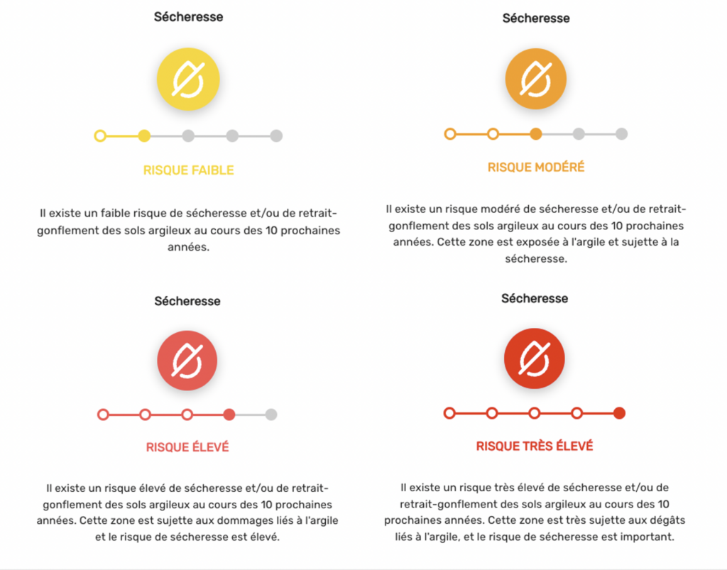
By taking into account the duration and intensity of droughts, namely the number of days with limited or no precipitation, and the increasing intensity of aridity in the near future based on climate projections, we built an index for drought threat. This index, when combined with the presence of clay in soil, provides an estimate of the geotechnical drought exposure of an area (Figure 1).

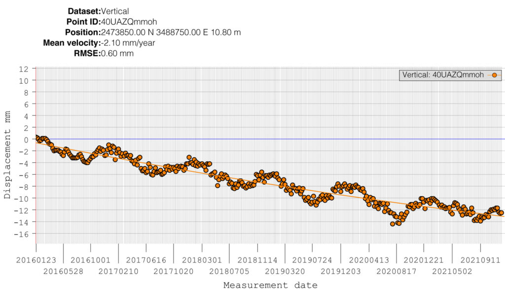
Synthetic aperture radar data from the european satellite Sentinel-1 confirm our numerical data, by providing observations of vertical ground movements. An example is demonstrated in Figure 2, which shows that a neighborhood in Bordeaux has sank up to 1.5 cm since 2016 and the presence of clay on soil creates inter-annual variations that can lead to cracks on buildings.

Figure 2. Time-series of satellite observations for vertical ground movement between 2016 and 2021 in Bordeaux. Data: Copernicus – European Ground Motion Service
If you want to know more about how drought and clay can impact buildings, send us a message to provide you with a D4Home demo.
