Where has the rain gone?
You may have noticed that for the last 3 weeks, rainfall in France has been a rare sight and mostly in the most southern parts of the country. So, where has the rain gone this winter?
The lack of rainfall and snowfall is attributed to a large anticyclone that extends from the Atlantic Ocean to western and central Europe. In Meteorology, this is called a “blocking high” weather system because it blocks the usual tracks of cyclones (west to east).
The first map shows the anomaly of sea-level pressure (in hPa) between 20 January and 7 February 2023, with respect to the mean values in the period 1991-2020. The red and orange shading denote the mean extent of the blocking anticyclone.

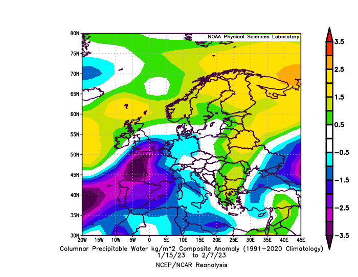
And this weather pattern has led to the lack of available moisture in the atmosphere to fall as rainfall or snowfall. The following map shows the departure of precipitable water values (in mm) between 15 January and 7 February 2023 from the climatological values. Most of France has way less available moisture than it usually has this time of the year (purple shading).
Will this pattern continue? The only certain thing we know is that the blocking high after about a month over western Europe, will gradually become weaker in mid-February. Some rainfall will fall after St Valentine’s day, but not in great amounts. France may have entered another drought period.